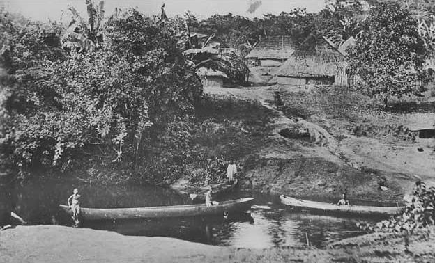
Figure 1.-- This is a scene in southern Sierra Leone, arond the village of Mafulomoo. We see a small stream, dugout canoes and part of the village. Until very modern times, rivers and streans were the primary commercial routes. See |

|
Sierra Leone is a small West African nation bordering on the Atlantic Ocean. It is llocated just beyond the bite of Africa where the coastline receeds tothe east. Sierra Leone is surrounded by Guinea in the north and northeast and Liberia in the south. Thre are four distinct ecological areas, three belt-like formation and eastern mountauns. The coastal terraine is swampy with mangroves facing the ocean. The swampy belt gives way to wooded hills, and finally grassland plateaus in the interior. There are mountains in the east. Mount Bintumani reaches 6,390 feet (1,948 m). Sierra Leone is well watered with several rivers generally running southeast from the interior highland plateau to the coast. The rivers were the primary trade routes until modern times. The country has a tropical climate because it is located just north of the equator.

Navigate the Boys' Historical Clothing Web Site:
[Introduction]
[Activities]
[Biographies]
[Chronology]
[Cloth and textiles]
[Clothing styles]
[Countries]
[Topics]
[Bibliographies]
[Contributions]
[FAQs]
[Glossaries]
[Images]
[Links]
[Registration]
[Tools]
[Boys' Clothing Home]
Navigate the Boys' Historical Clothing national pages:
[Return to the Main Sierra Leone page]
[Return to the Main African country page]
[Return to the Main African page]
[Algeria]
[Angola]
[Ivory Coast]
[Kenyan]
[Liberia]
[Madagascar]
[Mali]
[South Africa]
[Uganda]