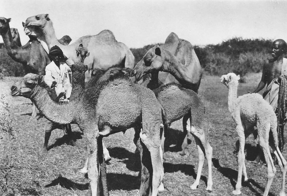
Figure 1.--Much of Somalia is very arid and includes part of theOgaden Desert. hus traditionally camels have bee very important to the economy. |

|
This East African country is centered on the Horn of Africa giving it a very strategic location. The Horn jutts out into the Indin Ocean. KIt is a peninsula along the coast of East Africa that separates the Gulf of Aden to the north and the Indian Ocean / Arabian Sea to the east and south. Thus the Horn is a kind of wedge beteen these two bodies. As the Guld of Aden leass into the Red sea and Suez Cana, Somalia and the Horn is a very strategic location. This makes the Gulf of Aden i crucial shipping lane, especial for oil tankers headed to Europe. The Gulf of Aden is essentially an inlet of the Indian Ocean, and separates the country from Yemen, historiclly an important trade route. The eastern coast of Somalia fronts directly on the Indian Ocean. Somalia is bounded by Djibouti in the northwest, Djibouti and Ethiopia in the west, and Kenya in the southwest. The country is slightly smaller than the state of Texas. there are few rivers or other dependable sources of fresh water. Two small rivers are the Shebelle and the Juba. The topography is mostly plateau regions that rise to more broken hilly areas in the northeast. Ethiopia and Somalia share thevOgaden Desert. Somalia is dominated by arid scrubland and desert-like condirions. One source suggests only about 13 percent of the land is arable, This my be a high estkimate and during periodic droughts is much lower. Somalia has serious food and water management problems that result in periodic crisis. Somalia has an arid or semiarid climate gpending on the region. There are normally four seasons, controlled by Infian Ocean phenomenon. two with some rain and two essentially without rain. December through March is the season of the northeast monsoon winds, is a very dry season, with moderate temperatures experienced in the north, but high temperatures in the south. April through June is the spring-like rainy season accompanied by hot temperatures. July through September is the time of the southwest monsoon winds, a dry and hot season. Finally October and November is a humid, but only sporadically rainy season. Somalia lives on a a climatic razor edge. During non-drought periods, Somalia's average annual rainfall is only 28 centimeters (11 inches). Droughts can develop when rainfall falls even slightly. Their impact can be very serious by the cpmmon over-grazing in many arable areas, poor land management leading to erosion, disruptions of nomadic routes, and breakdowns in water access and food distribution because of unsable politicl situtions cause ny Islamic terror groups. Ironically, these problems can also cause severe flooding. Droughts are all too common in Somalia. Major droughts plagued Somalia in 1974-75, 1984-85, 1992, 1999, and 2001. Flooding caused damage in 1997 and 2002. Between July 2011 and mid-2012, a severe drought affected the entire East Africa region (2011-12). Experts call it, "The worst in 60 years." The drought caused a devestating food crisis across Somalia, Djibouti, Ethiopia and Kenya that threatened the lives of some, 9.5 million people. The drought was especially ecere alongbthe central Indian Ocean coast.

Navigate the Boys' Historical Clothing Web Site:
[Introduction]
[Activities]
[Biographies]
[Chronology]
[Cloth and textiles]
[Clothing styles]
[Countries]
[Topics]
[Bibliographies]
[Contributions]
[FAQs]
[Glossaries]
[Images]
[Links]
[Registration]
[Tools]
[Boys' Clothing Home]
Navigate the Boys' Historical Clothing national pages:
[Return to the Main Somali page]
[Return to the Main African page]
[Angola]
[Cape Verde Islands]
[Democratic Republic of the Congo]
[Gabon]
[Lessotho]
[Madagascar]
[Mali]
]South Africa]
[Uganda]
[Portugal]