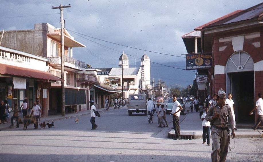
Figure 1.-- Here we see a scene from a small town in the interior highlands of Honmduras, probably in the early-1960s. |

|
Honduras is set in the middle of South America along the Caribbean Sea. It is bordered by Guatemala to the northwest, El Salvador to the south, and Nicaragua to the southeast. Honduras also has a 700-kilometer (430-mile) Caribbean coastline and beautiful off xhore iuslands. The Caribbean coast is situates between the mouth of the Río Motagua in the west (an important Mayan trade route) and the mouth of the Río Coco in the east at Cape Gracias a Dios. Honduras has three distinct topographical regions: an extensive interior highland and two narrow coastal lowlands. The interior makes up nearly 80 percent of the country's terrirorry which is ruuged and mountainous. The larger Caribbean lowlands in the north and the Pacific lowlands bordering the Gulf of Fonseca dominated by alluvial plains. Honduras is the second largest country in Central America and unlike neigboring El Salvador, relativerly sparsely populated. The major cities are Tegucigalpa, San Pedro Sula, La Ceiba, Tela, and Utila. Tegucigalpa is the capital of Honduras and located in central Honduras. It was founded as a gold and silver mining center (1536). San Pedro Sula is the financial and industrial center.

Navigate the Boys' Historical Clothing Web Site:
[Return to the Main Honduran page]
[Return to the Main Central American page]
[Return to the Main Latin American page]
[Return to the Main countries page]
[Introduction]
[Activities]
[Biographies]
[Chronology]
[Cloth and textiles]
[Clothing styles]
[Countries]
[Topics]
[Bibliographies]
[Contributions]
[FAQs]
[Glossaries]
[Images]
[Links]
[Registration]
[Tools]
[Boys' Clothing Home]