
Ecuadorian Geography
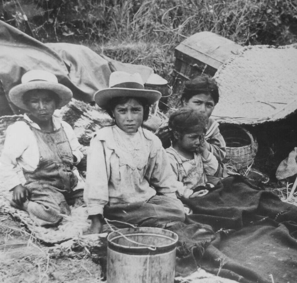
Figure 1.-- Ecuador is located on the southeastern vector arc of the Pacific Rim of Fire. Volcanoes have arisen along the subduction areas Some of the largest are in Ecuador (Cotopaxi, Pichincha, and Chimborazo). One impact is earthquake activity. Here we see the survivirs of a 1938 earthquake. The press caption read, "Lucky! They escaped death in Ecuadorian Quake: The watering town of Tinga, near Quito, Ecuador's capital, received the bruntthe severe eathquake which recently shook the central section of the country, doing extensive damage and cusing some loss of life. These four lucky survivors of the catastrophe had a very narrow escape from death. They managed to crawl from their home after three walls and the roof had crashed about them. Their parents were injured, but not one these tots was so much as scatched." | |
Ecuador is the smallest of the four Pacific-coast Andean republics. It is bordered by Columbia to the north and Peru to the east and south. To the west is the Pacific Ocean. The country also possesses the fabulous Pacific Galapagos Islands. The country's geography is notable for two reasons. First as indicated by its name, the eqator pases through the country. Second, the great diversity of climates and terraine in such a small country. The country is divided into three climatic zomes. Ecuador has a western tropical Pacific coast, the temperate central Andean highlands (sierra), and tropical eastern Amazonian lowlands. The variations in elevations means that Ecuador despite being on the equator experiences a substantial variaties in climate. The coast include both tropical jungle and arid areas. There the higher inland elevations have a cool, temperate climate with both lush well-watered areas in the north and near desert conditions in the south. The sierra includes majectic white snowcaps. They are volcanic in origin, several stii active. The most impressive are: Cotopaxi, Pichincha, and Chimborazo. The tropical Amazonian areas receive approximately 0.5 meters of rainfall annually creating a dense, green tropical rain forest. Ecuador because of its geography Ecuador often is struck by floods, earthquakes, volcanic eruptions, and landslides. The periodic El Niño cycles bring both drought and intense rainfall creating floods. At times Ecuador also is is struck by drought. Ecuador is located between lush coastal areas to the north (Colombia) and arid coastal areas to the south (Peru). South of Lima is the driest place on earth--the Atacama Desert. Today there are man-made environmental issues caused by pollution, erosion, and deforestation. The sierra highlands consists of the Cordillera Central Range and the Cordillera Occidental (western) Range. The ranges are the cause of many basins and a deep valley alongside, which are ideal places for raising grazing animals. Productive agricultural areas are located next to the rivers that flow down from the sierra and at the foot of the mountains.
CIH

Navigate the Children in History Website:
[Return to the Main Ecuadorean page]
[Return to the Main South American economy page]
[Return to the Main Latin American economy page]
[Return to the Main Latin American page]
[About Us]
[Introduction][Biographies][Chronology][Climatology][Clothing][Disease and Health][Economics][Freedom][Geography][History][Human Nature][Law]
[Nationalism][Presidents][Religion][Royalty][Science][Social Class]
[Bibliographies][Contributions][FAQs][Glossaries][Images][Links][Registration][Tools]
[Children in History Home]
Created: 8:02 PM 4/28/2019
Last updated: 8:02 PM 4/28/2019