|
Readers can look up the South American country pages by region. The 13 countries of South America can be divided into several distinct regions. The regions vary greatly in topography, altitude, climate, flora and fauna, and precipitation. The individual country borders overlap several regions with several countries split between the regions. The most distinctive region is the Andes region which dominates the west or Pacific coast. The Andes stretch from central Venezuela along the Pacific coast of the Continent (Colombia, Ecuador, Peru, Bolivia and Chile) south to Tierra del Fuego. This was the core of Spanish influence. The Bolivian Altiplano is part of the Andes and unlike the rest of the Andes extends into the interior further than any other part of the Andes. Not only did the Conquistadores find Inca gold in the Andes, but later Spanish colonists would find a mountain virtually made of silver in Bolivia. It would fund the entire Spanish Empire and make Spain for a time an European superpower. Copper would play a major role in Chile and Peru. The Andes is one of the great mountain ranges of the earth with towering snow covered peaks even at the equator. It gave rise to the Inca Empire a great civilization that rose not in river valleys, but amidst great mountains. The Inca would conquer much, but not all of the Andes. The Inca achieved impressive crop yields in the Andes. Within their zone of control was the Atacama Desert, the driest place on earth. Eastern South America is more diverse. The heart of the continent is the Amazonian basin, one of earth's richest biological treasure troves. It is primarily dominated by Brazil, the former Portuguese colony. Several other countries have small areas of Amazonian territory, including most of the Andean countries. Brazil covers about half the Continent. The tropical Guianas (Guyana, Suriname, and French Guiana) comprise the northeast corner of the Continent, the one area not dominated by Portugal or Spain. Venezuela is a split country. The north is Andean. The Llanos in the south and eastern lowlands drained by the Orinoco is more connected with the the Guianas. There are also planes and rolling hills south of the Amazon, including the Chaco (Bolivia and Paraguay) and the Pampas (Uruguay and Argentina). The area is cut by the Brazilian Highlands, with the Amazon to the north and the São Francisco to the south. The area includes vast grasslands. The Pampas in Argentina is some of the most fertile agricultural lands in the Continent.
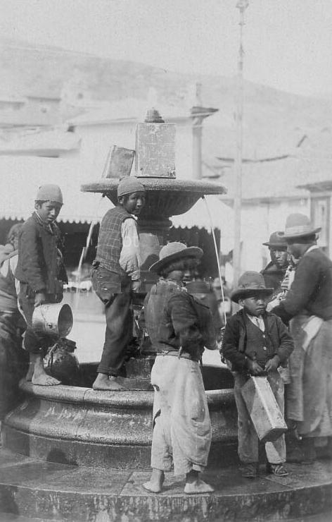
The most distinctive region in Latin America is the Andes region which dominates the western or Pacific coast. The Andes is one of the great mountain rages of the earth with the second highest peaks. They are part of the Pacific Ring of Fire and the result of plate convergence. Earthquakes occur regularly along with devastating coastal flooding. The Andes played a role in the development of Darwin's theory of Evolution when he found the shells of sea creatures high in the Andes. The Andes chain stretch from central Venezuela along the Caribbean to the Pacific coast of the Continent (Colombia, Ecuador, Peru, Bolivia and Chile) south to Tierra del Fuego. The Andes is one of the great mountain ranges of the earth with towering snow covered peaks even at the equator. It gave rise to the Inca Empire a great civilization that rose not in river valleys, but amidst great mountains. The Inca would conquer much, but not all of the Andes. The Inca achieved impressive crop yields in the Andes. Within their zone of control was the Atacama Desert, the driest place on earth. The Andes became core of Spanish or Hispanic influence. The Andes was heavily populated when the Spanish arrived. European diseases caused a population collapse. As a result, the Andean population today is a largely mestizo people. The Bolivian Altiplano is part of the Andes and unlike the rest of the Andes extends into the interior further than any other part of the Andes. The region also includes a narrow Pacific coastal strip which in areas is very arid. While small this strip, especially in northern Peru for a largely unknown reason played a major role in the development of Native American civilization. Not only did the Conquistadores find Inca gold in the Andes, but later Spanish colonists would find a mountain virtually made of silver in Bolivia which would have a major impact on the world economy. It would fund the entire Spanish Empire and make Spain for a time an European superpower. Copper would play a major role in Chile and Peru. The Andes is particularly pertinent to Americans. The American Left constantly blames the problems of Central America on the United States, ignoring over three centuries of Spanish colonial rule. The problem with this narrative is that the issues of Central America are essentially the same as the problems of the Andean countries where the United States has had very little impact.
Eastern South America is more diverse than the western Andean region. The heart of the continent is the huge Amazonian basin, one of earth's richest biological treasure troves. This ecological treasure house been protected by inaccessibility. The same is true for the people of the Amazon who fled deep into the rain forest jungle to escape the depredations of Portuguese slave hunters who moved up the Amazon from coastal settlements. The Amazon basin is the central part of South America drained by the Amazon River and its tributaries flowing from the eastern slope of the Andes. The source of the Amazon is Lake Lauricocha in the Peruvian Andes. The stream or small river flowing out of the Lake is still known as the Maranon although it is the upper course of the Amazon. The Amazonian Basin covers an area of over 2.7 million miles (6.9 million km) or about 40 percent of the entire continent. The Amazon is the greatest river on earth (by volume). The name refers to the women warriors of Greek myth. Spanish explorer Fransisco de Orellana in an expedition gone bad, sailed down the Amazon (1541). He encountered female warriors in Maranon and this was the inspiration for the great river's name. Orellana's expedition proved highly controversial because he broke off from the main force in Peru. But also he reported a large, highly developed population thriving in the Amazon. Scholars for centuries rejected these reports as fanciful. Archeologists are now finding evidence that is increasingly supporting Orellana's account. The geological structure of the Amazon Basin are two large stable masses of Pre-Cambrian rock, the Guiana Shield or Highlands in the north and the Central Brazilian Shield or Plateau in the south. The Amazonian Basin is dominated by Brazil, the former Portuguese colony. This is because Portugal dominated the coastal areas and could extend its influence up the river. The Spanish influence never extended beyond the Andes and it was a major effort to get to the small Andean tributaries. Several other countries have Amazonian territory, including most of the Andean countries, especially Bolivia in the south. Brazil alone because of its control of the Amazon covers about half the South American Continent.
The tropical Guianas (Guyana, Suriname, and French Guiana) comprise the northeast corner of the continent, the smallest region f South America. It is the one area of South America of which Portugal and Spain were unable to maintain control. The colonization of Guianas by Britain, the Netherlands, and France was solely due to sugar. They are small countries in both area and population. The Guianas face the Atlantic just east of the Caribbean. Venezuela is a split country. The north is Andean. The Llanos in the south and eastern lowlands drained by the Orinoco is geographically more connected with the the Guianas. The Guianas are the most tropical part of Latin America. Close to the Equator and with a climate which is not moderated by the high elevations of the Andes. The population is dominated by the captive Africans transported through the Atlantic Slave Trade and to a lesser extent, indentured laborers from India. The indigenous Amer-Indian peoples the Europeans were unable to enslave are today a small minority. most of the population lives along the northern Atlantic coast. All three of the Guianas are relatively poor countries, but the discovery of oil which is now being developed may change that. Venezuela claims about half of Guyana.
Southern South America is commonly called the Southern Cone because of its physical shape. It is the area of the continent that is south of the Tropic of Capricorn--meaning the only area of South America and most of the area and popular ion of Latin America with a temperate climate. It is an area of vast and fertile grasslands with enormous agricultural potential. Because of substantial European immigration, especially Italian, the Southern Cone is also a cultural sub-region with cultural differences from the rest of Latin America. The three major countries are Argentina, Chile and Uruguay, but Paraguay and southern Brazil can also be included. Argentina constitutes the bulk of the Southern Cone in both area and population. Argentina has a huge area of prime agricultural land as well as important natural resources. The economic problems experienced by Argentina in modern are purely related to abysmal governance. Uruguay is similar to Argentina, a much smaller country, but part of the fertile southern grasslands. Chile is part of the Southern Cone, but not part of the southern grasslands. It is such a narrow country that is more commonly seen as an Andean country. The Southern Cone benefits from the planes with grasslands and rolling hills south of the Amazon, including the Chaco (Bolivia and Paraguay) and the Pampas (Uruguay and Argentina). Southern Brazil is also part of the southern grasslands and notable as the most densely populated area of the southern Cone. The area is cut by the Brazilian Highlands, with the Amazon to the north and the São Francisco Rivers to the south. The area includes vast grasslands. The Pampas in Argentina is some of the most fertile agricultural lands in the Continent. The Southern Cine is not only distinctive geographically, but culturally. The culture is more European than the rest of the Continent. The Native American population (except in Paraguay) was basically exterminated. DNA studies show, however, that there is a major Native American population component. The Spanish provided the original European settler groups. Other Europeans came, especially Italians (19th and early-20th century). Argentina and Uruguay of all the Latin Americans counties at the time of World War I almost made the transition to becoming modern developed nations, but failed. The failure was primarily due to socialist policies that undermined the development of a functioning capitalist economy.

Navigate the Boys' Historical Clothing Web Site:
[Return to the Main South American regional page]
[Return to the Main South American page]
[Return to the Main Latin American page]
[Return to the Main countries page]
[Introduction]
[Activities]
[Biographies]
[Chronology]
[Cloth and textiles]
[Clothing styles]
[Countries]
[Topics]
[Bibliographies]
[Contributions]
[FAQs]
[Glossaries]
[Images]
[Links]
[Registration]
[Tools]
[Boys' Clothing Home]