|
Mexico is not easily divided into regions and there are different ways of doing this. We think the best regional divisions are seven distinct areas: Baja, northern, Gulf coat, central highlands, Pacific coat, Yucatan, and south.
Baja is one of two peninsular appendages. It is Mexico's smallest, most isolated region. It is the projection south from California and the full name is Baja California or Lower California. It might be included in the north or even the Pacific coast for simplicity, but has distinct characteristics. It is a coastal region bordering on both the Pacific Ocean and Sea of Cortez. It is a very arid area with no rivers. It is the smallest region in both area and population.
The north is the largest area. It constitutes about 40 percent of Mexican territory. Most of it is arid including border deserts which is why in addition to hostile Amer-Indian tribes that the north, including Texas, was not heavily populated in the era before the Mexican-American War (1846-48). Northern Mexico is still lightly populated, although growing because industry there can be tied into the American economy.
The Gulf of Mexico coast is a semi tropical area. The northern part might be included in the northern region and is also arid. The southern region is better watered with rivers running down from the central highlands. Mexico's major port is located here--Veracruz. It is where Cortez landed to begin the conquest of Mexico. It is the shortest point inland to Mexico City.
The central highlands is a band cutting east and west of Mexico city has the country's highest peaks as a result of a string of volcanoes. This is the heart of Meso-America and continues to be heart of Mexico today. Great Amer-Indian civilizations rose there. It was one of the six regions world wide where agriculture independent arose. Most were river vallieys. Latin America was a little different, more associated with volcanoes. Meso-America is more associated with the volcanic band across central America. And where the Amer-Indians developed the world's most important agricultural plant--corn.
The Pacific coast is a narrow coastal region west of the mountain chains running north and south through the south, central highland and northern region.
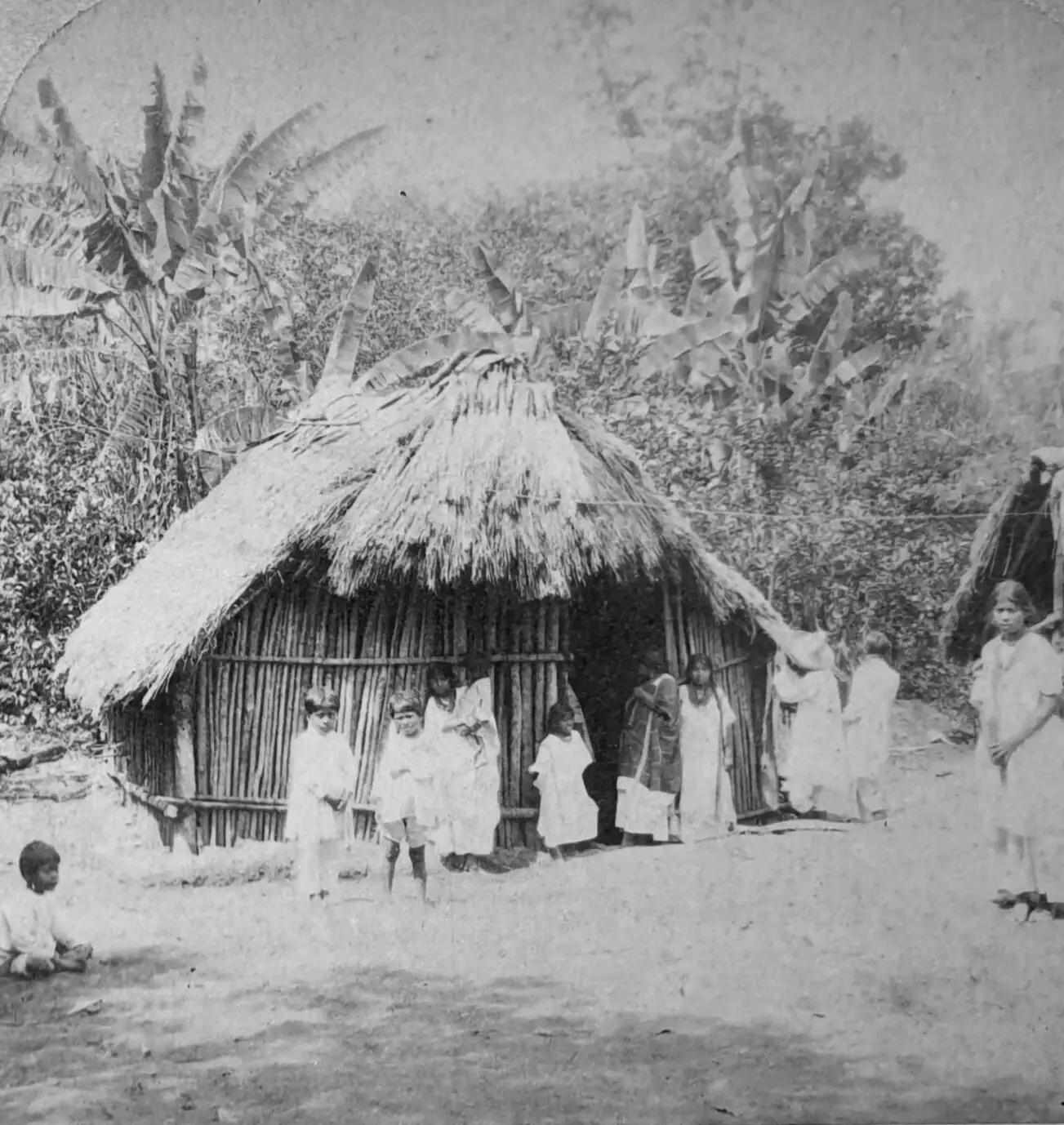
Southern Mexico is made up of tropical lowlands. The Mexican landmass narrows as it moves in a southeasterly direction from the United States border toward Central America. In the south bordering on Guatemala are dense rain forests--the homeland of the Maya.
Yucatan is one of two appendages. The Yucatan Peninsula in the southeast and Baja California in the far west. The Yucatan lies between the Gulf of Mexico and the Caribbean Sea. It along with the American Florida peninsula forms the Gulf of Mexico. There are no rivers in Yucatan, but there is ground water rising to cenotes in many areas.
Baja is one of Mexico's two peninsular appendages. It is Mexico's smallest, most isolated region. It is the projection south from California and the full name is Baja California or Lower California. It might be included in the north or even the Pacific coast for simplicity, but has distinct characteristics. It is a coastal region bordering on both the Pacific Ocean and Sea of Cortez. It is a very arid area with no rivers. It is the smallest region in both area and population. The major city is Tijuana bordering on the United States.
The north is Mexico's largest area, but lightly populated. It was hugely reduced by the Mexican American War (1846-48). It constitutes about 40 percent of Mexican territory. Most of it is arid including border deserts which is why in addition to hostile Amer-Indian tribes that the north, including Texas, was not heavily populated in the era before the Mexican-American War (1846-48). The arid conditions limited agriculture. This meant that few Mexicans lived in the area, a major factor in the losses to the United States. The area was largely used for cattle ranching leading to huge estates called haciendas. This gave rise to a very unequal social structure. Wealthy haciendados would dominate a landless peasantry eking out a meager existence at the subsistence level. Unlike the United States, there were no laws creating limited land owning and family farm patterns. This is the situation that gave rise to Pancho Villa and his opposition to the landed aristocracy would be a major factor in the Mexican Revolution, Villa's Army of the North would be a force to be reconned with. Northern Mexico is still lightly populated, although growing because industry there can be tied into the American economy.
The Gulf of Mexico coast Mexico's eastern coast is a semi tropical area. The northern part might be included in the northern region and is also arid. The southern region is better watered with rivers running down from the central highlands. Mexico's major port is located here--Veracruz. It is where Cortez landed to begin the conquest of Mexico. It is the shortest point inland to Mexico City. The Gulf Coast of Mexico extends along the Gulf of Mexico from the border with the United States at Matamoros to the tip of the Yucatán Peninsula at Cancún. We include the Yucatan bit around Campeche known as the Bay of Campeche in the Yucatan region. Major cities include Veracruz, Tampico, and Coatzacoalcos. The states include Tamaulipas, Veracruz, and Tabasco. Most of that stretch is the approximately 400-mile elongated, but narrow cresant state of Veracruz. In the pre-Colombian times, the region was inhabited by minor tribes. Most of the great Amer-Indian civilization were located in the Central Highlands. Civilization first appeared in this area, however, with the Olmecs, presumably because of the river valley conditions. Agriculture which was the basis of the economy was different than in the central highlands because of the semi-tropical conditions. The coast is largely low sandy stretches broken by tidewater streams and lagoons fed by rivers running down from the central highlands. The flat coastal area rises sharply inland as one moves west into the Sierra Madre Oriental. Here we see valleys covered by dense tropical rain forest until we get into the central highlands. Citlaltépetl (Orizaba Peak) is Mexico’s highest mountain (18,406 feet). It is situated at the collision of the Sierra Madre highlands and the Cordillera Neo-Volcánica. There are some 40 rivers and tributaries provide water for both irrigation and hydroelectric power. The rich silt carried down by rivers from the Central Highlands deposited in the valleys and coastal areas make the area a productive agricultural region. Veracruz city was Mexico's most imprtant port and as a result the most cosmopolitan city in the country. The most important industry, however, is the petroleum industry. There are important resources along the coast and offshore. Mexico's limitation on foreign participation, however, has limited development. As a result, the country has to import huge quantities of natural gas from the United States.
The central highlands is a band cutting east and west of Mexico city has the country's highest peaks as a result of a string of volcanoes. This is the heart of Meso-America and continues to be heart of Mexico today. Great Amer-Indian civilizations rose there. It was one of the six regions world wide where agriculture independent arose. Most were river vallieys. Latin America was a little different, more associated with volcanoes. Meso-America is more associated with the volcanic band across central America. And where the Amer-Indians developed the world's most important agricultural plant--corn.
Southern Mexico is made up of tropical lowlands. The Mexican landmass narrows as it moves in a southeasterly direction from the United States border toward Central America. In the south bordering on Guatemala are dense rain forests--the homeland of the Maya. The states are Oaxaca and Chiapas.
Yucatán is another of Mexico's two peninsular appendages. The Yucatán Peninsula in the southeast and Baja California in the far west. The Yucatán lies between the Gulf of Mexico and the Caribbean Sea. It along with the American Florida peninsula forms the Gulf of Mexico. There are no rivers in Yucatán, but there is ground water rising to cenotes in many areas. It was dominaed by the Maya.

Navigate the Children in History Web Site:
[Return to the Main Mexican geography page]
[Return to the Main Mexican page]
[Return to the Main Latin American history page]
[[Introduction]
[Biographies]
[Chronology]
[Climatology]
[Clothing]
[Disease and Health]
[Economics]
[Geography]
[History]
[Human Nature]
[Law]
[Nationalism]
[Presidents]
[Religion]
[Royalty]
[Science]
[Social Class]
[Royalty]
[Bibliographies]
[Contributions]
[FAQs]
[Glossaries]
[Images]
[Links]
[Registration]
[Tools]
[Boys' Clothing Home]
Navigate the HBC Mexican pages
[Mexican choirs]
[Mexican Scouts]
[Mexican school uniforms]
[Mexican communions]