
Greek Regions: Aegean Islands--The Cyclades
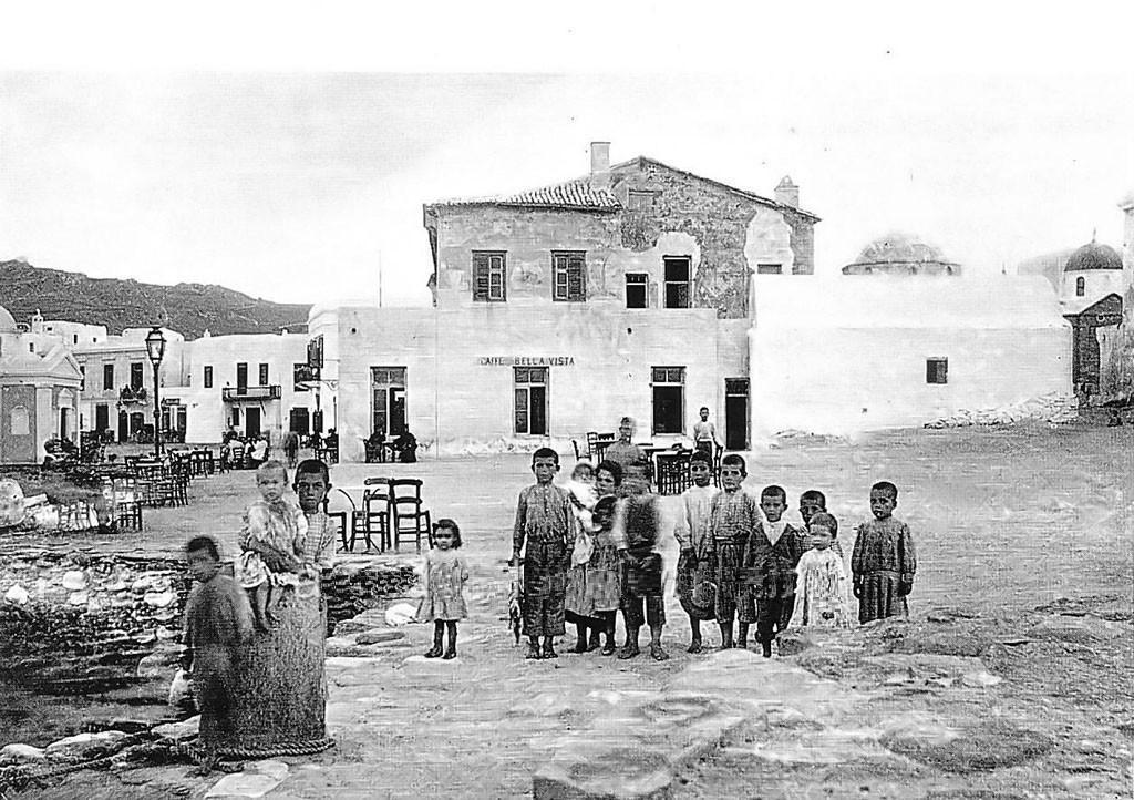
Figure 1.--This photograph was labeled 'Children on Mykonos Street'. We think that means childen on a street on Mykonos Iskand, one of the Cyclades. The common practice in Greece is that the name of the island itself is the same as the name of the principal town on that island. The island has a fascinating history, undegoing occupation by all the bgreat powers of the day, beginning with the Carians known to the Hittites. Noticin that one boy has a string of fish, suggesting an island. Also notice the children's short hair, including the girls. .
|
|
The Cyclades or Circular Islands are located in the southern Aegean Sea, southeast of mainland Greece. They dominate the southern Aegenian north of Crete. They are a forrmer administrative prefecture of Greece. Cyclades refers to the islands which form a circle around the sacred island of Delos.
Delos (Δηλος) was of great imprtance to the ancient Greeks considered sacred. The name derives from the Greek meaning 'Brilliant' It was the birthplace of both Artemis and Apollo. It was second in importance only to Delphi. It was literally covered by a wide range of temples and sanctuaries dedicated to a many gods. As aresul, it is now fascinating archaeological site. The largest island of the Cyclades is Naxos. The Cyclades comprise about 220 islands, most being small uninhabited islets of little importance. Even the major islands are all small, including Amorgos, Anafi, Andros, Antiparos, Delos, Ios, Kea, Kimolos, Kythnos, Milos, Mykonos, Naxos, Paros, Folegandros, Serifos, Sifnos, Sikinos, Syros, Tinos, and Thira or Santoríni.
Ermoupoli on Syros is the chief town and administrative center of the former prefecture. Geologically the islands are peaks of a submerged mountainous terrain. The primary exception are the two volcanic islands, Milos and Santorini. Besides Delos, Santorini was the site of one of the largest volcanic eruptions in recorded history--sometimes called the Thera eruption. It occurred about 3,600 years ago, notably the height of the Minoan civilization. The eruption left a large caldera which can be observed today. It is surrounded by volcanic ash deposits hundreds of metres deep. Many historians believe it may have led indirectly to the collapse of the Minoan civilization on Crete. The climate of these island is generally dry and mild, but with sole exception of Naxos the soil on these iallands is rocky amd not very fertile which limits the population that can be supported. The agricultural that does exist is similar to that of mainland Greece, mostly for grapes (wine production), fruit, wheat, olive (oil prouction), and im nodern times tobacco. Somewhat cooler temperatures are noted in in higher elevations. The islands experience very mild winters as a result of the warm Aegean waters. There are no islands to the south in between the Cyclades and Crete in the Sea of Crete.
HBC

Navigate the Boys' Historical Clothing Web Site:
[Return to the Main Aegean Islands page]
[Introduction]
[Activities]
[Biographies]
[Chronology]
[Clothing styles]
[Countries]
[Bibliographies]
[Contributions]
[FAQs]
[Glossaries]
[Images]
[Links]
[Registration]
[Tools]
[Boys' Clothing Home]
Navigate the Boys' Historical Clothing Belgin pages:
[Return to the Main Greek regional page]
[Greek choirs]
[Greek folk costumes]
[Greek movies]
[Greek royals]
[Greek schools]
[Greek youth groups]
Created: 7:26 PM 3/26/2019
Last updated: 7:26 PM 3/26/2019